General information
RDP Priority
- P2. Competitiveness
RDP Focus Area
- 2A: Farm’s performance, restructuring & modernisation
RDP Measure
- M04: Investments in physical assets
Beneficiary type
- Public authority / body
Summary
The Government of La Rioja promoted land consolidation in Arnedo to address the fragmentation and abandonment of small, scattered plots, which limited farm profitability and hindered agricultural innovation. The main goal was to create larger, better-shaped plots and improve access through a modern road network.
The process began in 2016 at the request of local landowners and followed the legal framework of Spain’s 1973 Agrarian Reform Law. Activities included landowner engagement, soil classification, and the design of new parcels based on value equivalence (using a rating-based system). Landowners continued to cultivate their original plots during the reorganisation phase. In 2021, 628 new plots were assigned to 433 owners, replacing 3 269 original plots.
In parallel, CAP support was used to design and build a network of rural roads to ensure all new plots had direct access, addressing long-standing conflicts over easements. Works took place between 2021 and 2022, and although final land titles are still being processed, owners are cultivating their new parcels and can request provisional certificates to sell or mortgage them. Land consolidation is seen as a key driver of rural revitalisation and agricultural modernisation.
Results
- Fuel consumption for the entire consolidated area has dropped, saving 6.72 litres/ha/year and contributing to improved energy efficiency and lower CO₂ emissions.

Promoter
Government of La Rioja
Funding
RDP support: 2 311 206.74 (EUR)
EAFRD: 1 155 603.40 (EUR)
National/Regional: 1 155 603.34 (EUR)
Context
EAFRD funding was used for the construction of a rural road network in the framework of a land consolidation process project in Arnedo. Land consolidation in La Rioja is still governed by a national law from 1973 (the Law on Agrarian Reform and Development). The consolidation process begins at the request of the majority of landowners in a given area. The procedure involves identifying and classifying all existing plots, grouping them together, and then redistributing them as new, larger, and more agriculturally competitive plots. This greatly facilitates efficient machinery use and improves overall farming conditions.
Throughout the process, strict legal guarantees are observed, such as public consultations and periods for objections and appeals. The road construction is implemented to ensure proper access to all new plots. While the formal beneficiary of the funding is the regional administration, the completed roads are ultimately handed over to the local municipality for public use and maintenance. In this sense, the road network cannot be understood in isolation, as it directly responds to the needs arising from the prior land reorganisation.
Objectives
The main objective of the project has been to restructure and modernise agricultural land in the municipality of Arnedo to boost competitiveness and prevent rural decline. Specific objectives were to:
- improve the competitiveness of agricultural holdings;
- significantly reduce fuel consumption;
- optimise travel time between plots; and
- improve direct access to farmland through the construction of new rural roads.
Activities
The land consolidation process itself involved public meetings with local landowners and two field visits in order to explain the benefits of land consolidation, the legal procedures, and the available CAP support. This outreach phase helped reduce opposition and secured the legally required support of over 51% of landowners.
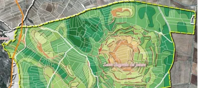
The municipal council submitted the joint request on behalf of 433 landowners and was the liaison point during the whole process. Owners filled standard forms listing 3 269 plots. Technical staff from the regional administration used Global Navigation Satellite System (GNSS) equipment to verify the exact boundaries of each plot. The result was a fully georeferenced cadastre that served as the foundation for all subsequent stages of the process. Over four months, a classification board was set up specifically to assess the land and classify the soils into eight fertility categories across the entire area by establishing a point-based rating system. 433 surveys captured owners’ location preferences. Geographic Information System (GIS) software produced 628 draft replacement holdings, minimising machinery turns and giving every holding direct road access.
A draft plan was presented, with a 30-day objection period, and then approved by ministerial order. In addition, a 52 km network was designed, re-using old tracks where possible and improving their layout, widening paths and adapting slopes to modern agricultural machinery. The land consolidation led to a significant structural reorganisation of agricultural holdings. The number of plots was reduced from 3 269 to 628, decreasing the average number of plots per owner from 7.54 to 1.35 and increasing the average plot size from 0.37 ha to 1.94 ha.
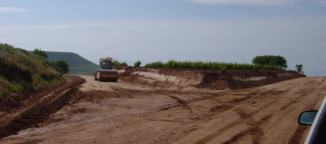
As part of this process, CAP support under Measure 4 – Investments in physical assets was used to finance the construction of the new road network, including the construction of five-meter-wide gravel roads, culverts, and signage. The new infrastructure allows safe circulation for tractors of 200 hp or more.
Main results
- Fuel consumption for the entire consolidated area has dropped from 45 239.84 to 37 030.62 litres/year, saving 8 209.22 litres annually (6.72 litres/ha/year), contributing to improved energy efficiency and lower CO₂ emissions.
- Qualitative surveys showed increased land value, reduced labour time, reduced costs and overall higher profitability for farmers.
- In general, most landowners expressed high satisfaction with the size and location of their new holdings at the end of the process.
Key lessons
- One of the main lessons from the Arnedo land consolidation is the importance of communication and transparency throughout the process. Initial resistance among landowners is common in this type of process due to uncertainty and fear of receiving less valuable land. Clearly explaining that the allocation is based on a rating system, not a lottery, helps to gain trust.
- Coordinating the road infrastructure with a new plot design was another key takeaway, ensuring that all new parcels have direct road access. This element is highly valued by landowners and avoids future disputes.
- For similar initiatives, the project holders recommend securing strong local support, ensuring early technical groundwork, and fostering land transactions during the process to maximise efficiency and reduce land fragmentation. When well-executed, land consolidation proves a powerful tool for rural revitalisation.
People are generally afraid… they know the plots they own, but not what they’ll end up with. But experience shows that after two or three years, if you ask them, no one wants to go back to the previous situation.
We see this as a powerful driver to sustain agriculture in struggling rural areas that need a boost to remain viable.
José Luis Soba
Head of Agricultural Infrastructure Service

