LAG SIRET BÂRLAD EST
(GRUPUL DE ACȚIUNE LOCALĂ SIRET BÂRLAD EST)

Details
- National LAG Code
- 36878500
- Spoken languages
- English, Romanian
- Main Fund
- European Agricultural Fund for Rural Development
- Main Programme
- CAP Strategic Plan - Romania
- Additional Fund
- European Social Fund Plus
- Number of LAG staff
- 5.0
Physical & demographic characteristics of LAG area
The partnership that forms the Local Action Group (LAG) Siret Bârlad Est is legally organized in accordance with the provisions of Government Ordinance 26/2000 and brings together 25 partners: 7 public partners, 12 private partners, and 6 NGOs.
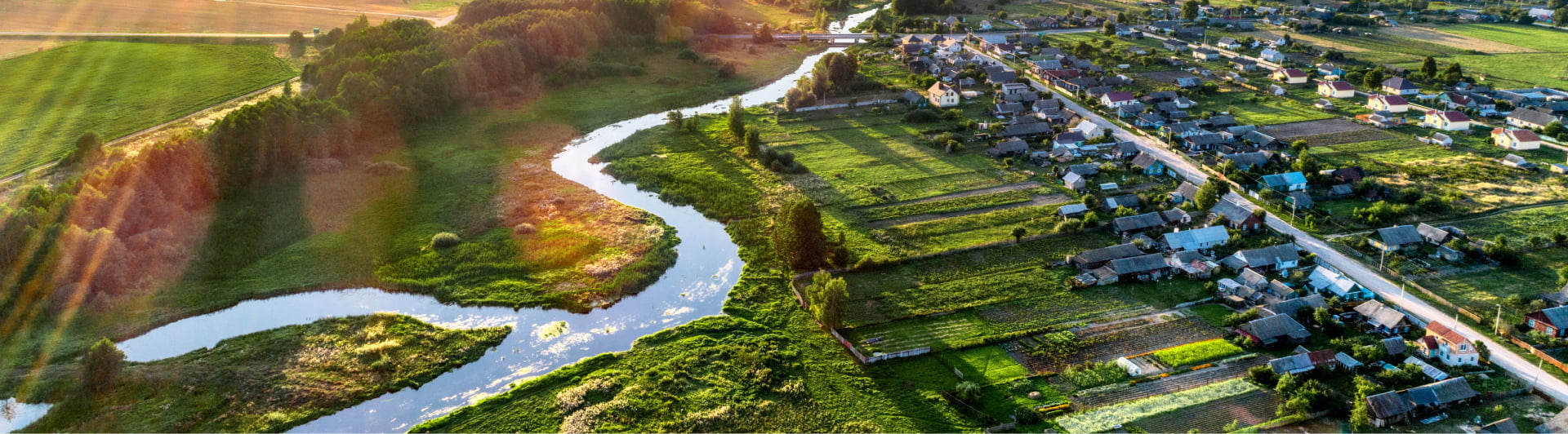
The territory covered by LAG Siret Bârlad Est is entirely located within Galați County (Development Region 2 South-East) and spans an area of 418.14 km², as established by Local Council Decisions for the 7 communes. No administrative-territorial unit is included in the territory of another LAG.
According to official data published by the National Institute of Statistics following the 2021 population census, the population of the territory is 36,455 inhabitants, with a population density of 84.87 inhabitants/km². The LAG’s population represents 7.33% of the total population of the county.
Assets & land use of the LAG area
The territory features a varied landscape, situated at the intersection of hills and plains, and includes three characteristic relief zones: the floodplain area, the high plain area, and the transitional zone between the floodplain and the plain.
Due to its western location, the entire area of the partnership falls within the temperate continental climate zone.
Soil, the primary means of agricultural production, is under significant pressure, which affects both its quality and the level of agricultural output. Soil degradation through erosion or the influence of various harmful factors can occur rapidly. Geologically, the territory of the LAG belongs to the structural unit known as the Scythian Platform, representing a rigid region composed of crystalline and old sedimentary rocks.
The hydrographic network of the territory is dominated by the Bârlad River, the Siret River, the Suhurlui stream, and the Geru River. Surface water flow is directly influenced by precipitation, with peak flo
- Decision-making body's entities number
- 5 entities
- We cover
- 36 455 people
- Our territory is
- 418.00 km²
- We operate in
- 7 municipalities
Costache Negri, Griviţa, Iveşti, Movileni, Pechea, Umbrăreşti, Cuza Voda
LAG strategy
Key Themes of LAG Strategy
The LEADER concept promotes local rural development by involving communities in creating and implementing Local Development Strategies. Based on the idea that local involvement improves quality of life, LEADER supports balanced growth, economic diversification, and better governance. Strategies are built on local needs and focus on sustainable use of economic, natural, and human potential. Projects funded by public money aim to reduce social and economic gaps. Cooperation with other LAGs, both in Romania and internationally, ensures long-term sustainability of goals and integrated rural development.
Contacts
Main contact
- str. Alexandru Ioan Cuza nr. 76, 807271 Com. CUZA VODĂ, jud. GALAȚI - Romania
- galsiretbarlad@gmail.com
- +40 740202222
Cooperation contact
- Sorin Lacatusu
- sorin_lacatusu@yahoo.com